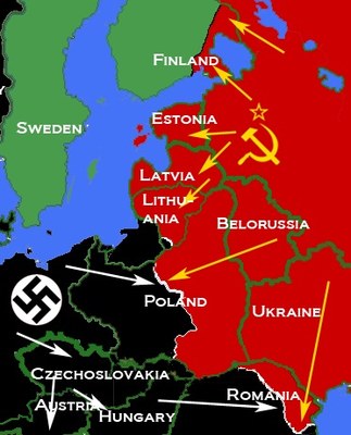
Karte Ost-/Mitteleuropa 1938-1941 IMG
by
—
last modified
2020-05-25T11:07:23+02:00
Wikimedia Commons, Creative Commons Attribution-Share Alike 3.0 Unported.
Wikimedia Commons, Creative Commons Attribution-Share Alike 3.0 Unported.
Map depicting most of Central and Eastern Europe, showing 1938 borders, along with Axis (black) and Soviet (red) military and political advances until late 1940, unbekannter Ersteller, Quelle: Wikimedia Commons: https://commons.wikimedia.org/wiki/File:Nazi-Soviet_1941.png, Creative Commons Attribution-Share Alike 3.0 Unported.

