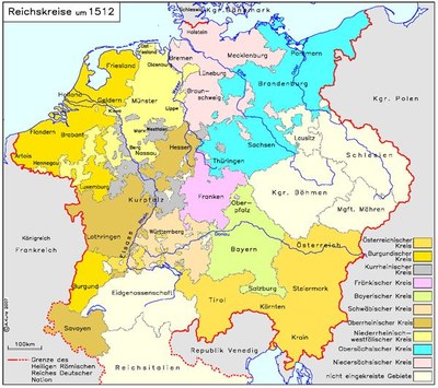
Imperial Circles around 1512
erstellt von
—
last modified
2022-01-21T17:32:16+02:00
IEG-MAPS · Server für digitale historische Karten, CC BY-NC 4.0 International
Contributors: Andreas Kunz
IEG-MAPS · Server für digitale historische Karten, CC BY-NC 4.0 International
Joachim Robert Moeschl, Imperial Circles ca. 1512, color graphic, 2008; source: IEG-MAPS, Institut für Europäische Geschichte, Mainz / © Andreas Kunz, 2008. URL: http://www.ieg-maps.uni-mainz.de/mapsp/mapp512RKreise.htm.

