"Entdeckung und Besiedelung" 1850–1890

erstellt von U.S. Dept. of the Interior, Geological Survey zuletzt geändert 2020-05-25T10:19:49+01:00
Mit freundlicher Genehmigung der University of Texas Libraries, The University of Texas at Austin.
U.S. Dept. of the Interior, Geological Survey, Exploration and Settlement 1850–1890, in: The National Atlas of the United States of America (Arch C. Gerlach, Hg.). Washington, D.C.: U.S. Dept. of the Interior, Geological Survey, 1970. Bildquelle: Perry-Castañeda Library Map Collection. Mit freundlicher Genehmigung der University of Texas Libraries, The University of Texas at Austin. http://www.lib.utexas.edu/maps/united_states/exploration_1850.jpg, gemeinfrei.

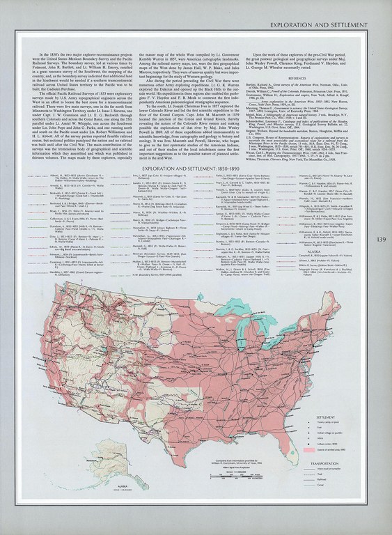
U.S. Dept. of the Interior, Geological Survey, Exploration and Settlement 1850-1890, in: The National Atlas of the United States of America (Arch C. Gerlach, editor). Washington, D.C.: U.S. Dept. of the Interior, Geological Survey, 1970. Source: Perry-Castañeda Library Map Collection. Courtesy of the University of Texas Libraries, The University of Texas at Austin. http://www.lib.utexas.edu/maps/united_states/exploration_1850.jpg, public domain.


U.S. Dept. of the Interior, Geological Survey, Exploration and Settlement 1850–1890, in: The National Atlas of the United States of America (Arch C. Gerlach, Hg.). Washington, D.C.: U.S. Dept. of the Interior, Geological Survey, 1970. Bildquelle: Perry-Castañeda Library Map Collection. Mit freundlicher Genehmigung der University of Texas Libraries, The University of Texas at Austin, gemeinfrei.


Außereuropäische Welt
Migration, Reise
IEG(http://www.ieg-mainz.de)
ja
Medienbeschreibung
HTML
EGO(http://www.ieg-ego.eu)
Deutsch
1850
1890
1850 - 1859, 1860 - 1869, 1870 - 1879, 1880 - 1889

Entdeckung und Besiedelung 1850–1890
Bild
Kein Bild
Englisch
Deutsch, Englisch
Keine Datei
Keine Datei