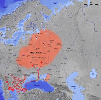
Map of the Kievan Rus', 11th century
by
—
last modified
2 years ago
Wikimedia Commons, Creative Commons-Lizenz Namensnennung-Weitergabe 3.0 Unported
Wikimedia Commons, Creative Commons-Lizenz Namensnennung-Weitergabe 3.0 Unported
Kievan Rus, 11th century, map, 2006, copyright: Captain Blood, Britta Müller-Schauenburg, http://commons.wikimedia.org/wiki/File:Kievan_Rus_en.jpg?uselang=de, https://creativecommons.org/licenses/by-sa/3.0/
Northeastern Europe@Northeastern Europe@(BE)@freigabe
Russification / Sovietization in Culture and Society@Culture and Society@(BE)@freigabe
The Northern Black Sea Region@Northern Black Sea@(BE)@freigabe


 Creative Commons License Attribution-ShareAlike 3.0 Unported (CC BY-SA 3.0 DEED),