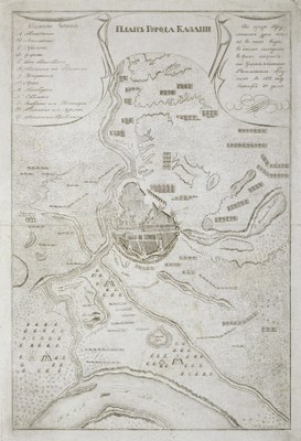
Map of the City of Kazan in the 16th Century

by Kotelnikov last modified 2022-10-20T09:32:53+01:00
Contributors: Kotelnikov

The image is used from www.hermitagemuseum.org, courtesy of The State Hermitage Museum, St. Petersburg, Russia
Map of the City of Kazan in the mid-16th Century, lithograph, ca. 1830, artist: Kotelnikov; source: The image is used from www.hermitagemuseum.org, courtesy of The State Hermitage Museum, St. Petersburg, Russia, https://www.hermitagemuseum.org/wps/portal/hermitage/digital-collection/04.+engraving/1625565, Image Usage Policy https://www.hermitagemuseum.org/wps/portal/hermitage/about/image_usage_policy?lng=en.

Karte der Stadt Kazan IMG

This map from the 1830s depicts the siege of the city of Kazan in 1552. The siege lasted from August to October and ultimately decided the Russo-Kazan War. Subsequently the Khanate of Khazan, which since 1438 had been the successor to the Golden Horde with Kazan as its capital, became part of the Russian Empire.


Map of the City of Kazan in the mid-16th Century, lithograph, ca. 1830, artist: Kotelnikov; source: The image is used from www.hermitagemuseum.org, courtesy of The State Hermitage Museum, St. Petersburg, Russia, https://www.hermitagemuseum.org/wps/portal/hermitage/digital-collection/04.+engraving/1625565, Image Usage Policy https://www.hermitagemuseum.org/wps/portal/hermitage/about/image_usage_policy?lng=en.


Eastern Europe
Politics, Social Matters, Society, Religion
IEG(http://www.ieg-mainz.de)
yes
Media Description
HTML
EGO(http://www.ieg-ego.eu)
English
1830
1830
1830 - 1839

Map of City of Kazan
No image
German
German, English
No file
No file


Karte der Stadt Kazan IMG