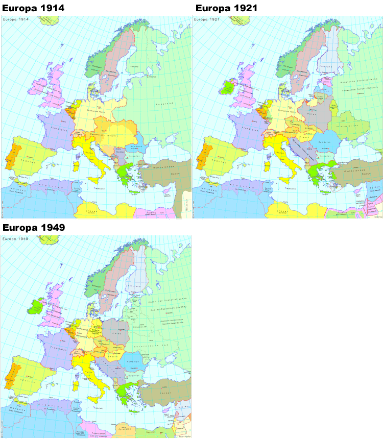
Animated map of Europe 1914, 1921 and 1949
erstellt von
—
last modified
2020-05-25T11:44:33+02:00
© IEG / A. Kunz 2003
© IEG / A. Kunz 2003
Map "Europa 1914"; source: Institut für Europäische Geschichte / Institute of European History, IEG-MAPS Server für digitale historische Karten, authors: A. Kunz / W. Röss, cartography: Joachim Robert Moeschl, editor: Andreas Kunz, © IEG / A. Kunz 2003, http://www.ieg-maps.uni-mainz.de/mapsp/mappEu914Serie1.htm. Map "Europa 1921"; source: Institut für Europäische Geschichte / Institute of European History, IEG-MAPS Server für digitale historische Karten, author: A. Kunz, cartography: Joachim Robert Moeschl, editor: Andreas Kunz, © IEG / A. Kunz 2003, http://www.ieg-maps.uni-mainz.de/mapsp/mappEu921Serie1.htm. Map "Europa 1949"; source: Institut für Europäische Geschichte / Institute of European History, IEG-MAPS Server für digitale historische Karten, author: A. Kunz, cartography: Joachim Robert Moeschl, editor: Andreas Kunz, © IEG / A. Kunz 2003, http://www.ieg-maps.uni-mainz.de/mapsp/mappEu949Serie1.htm.
Border Regions@Border Regions@(ÜB)@freigabe
Forced Ethnic Migration@Forced Ethnic Migration@(ÜB)@freigabe
The Northern Black Sea Region@Northern Black Sea@(BE)@freigabe

