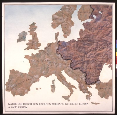
A Map of Europe Divided by the Iron Curtain

erstellt von unknown artist last modified 2020-05-25T10:31:03+01:00
Hungarian National Museum
Karte des durch den Eisernen Vorhang getrennten Europa, no date, unknown artist; source: Hungarian National Museum, http://www.hnm.hu/en/kiall/kia_allando2_11.html.

Karte des durch den Eisernen Vorhang getrennten Europa IMG

This Hungarian map depicts the European continent with the familiar dividing line of the Iron Curtain, which politically separated western Europe from eastern Europe (which was under the influence of the Soviet Union) after 1945.


Karte des durch den Eisernen Vorhang getrennten Europa, no date, unknown artist; source: Hungarian National Museum.


Mitteleuropa, Balkanhalbinsel, Osteuropa, Nordeuropa, Westeuropa, Südeuropa
Politik
IEG(http://www.ieg-mainz.de)
yes
Medienbeschreibung
HTML
EGO(http://www.ieg-ego.eu)
Englisch
1945
1990
1940 - 1949, 1950 - 1959, 1960 - 1969, 1970 - 1979, 1980 - 1989

Map of Europe Divided by
Bild
No image
Deutsch
Deutsch, Englisch
No file
No file