Karte der Niederlande (1559–1609)

Die Niederlande 1559–1609, Karte, 1923, unbekannter Ersteller; Bildquelle: Shepherd, William R.: The Historical Atlas, New York 1923. Digitalisat: The University of Texas at Austin, http://www.lib.utexas.edu/maps/historical/shepherd/netherlands_1559-1608.jpg.
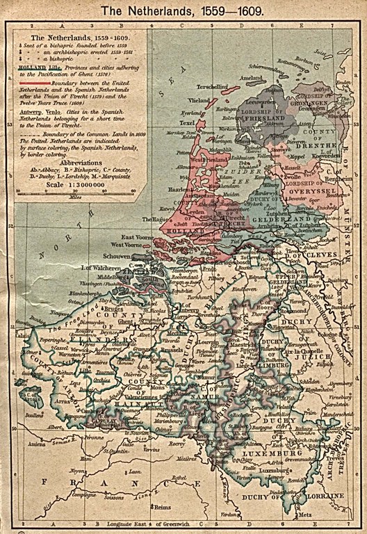
Die Niederlande 1559–1609, Karte, 1923, unbekannter Ersteller; Bildquelle: Shepherd, William R.: The Historical Atlas, New York 1923. Digitalisat: The University of Texas at Austin, http://www.lib.utexas.edu/maps/historical/shepherd/netherlands_1559-1608.jpg

Die Niederlande 1559–1609, Karte, 1923, unbekannter Ersteller; Bildquelle: Shepherd, William R.: The Historical Atlas, New York 1923. Digitalisat: The University of Texas at Austin, http://www.lib.utexas.edu/maps/historical/shepherd/netherlands_1559-1608.jpg.


Westeuropa
Politik
IEG(http://www.ieg-mainz.de)
nein
Medienbeschreibung
HTML
EGO(http://www.ieg-ego.eu)
kein Auswahl
1550 - 1559, 1600 - 1609, 1580 - 1589, 1590 - 1599, 1560 - 1569, 1570 - 1579

Bild
Kein Bild
kein Auswahl
Keine Datei
Keine Datei