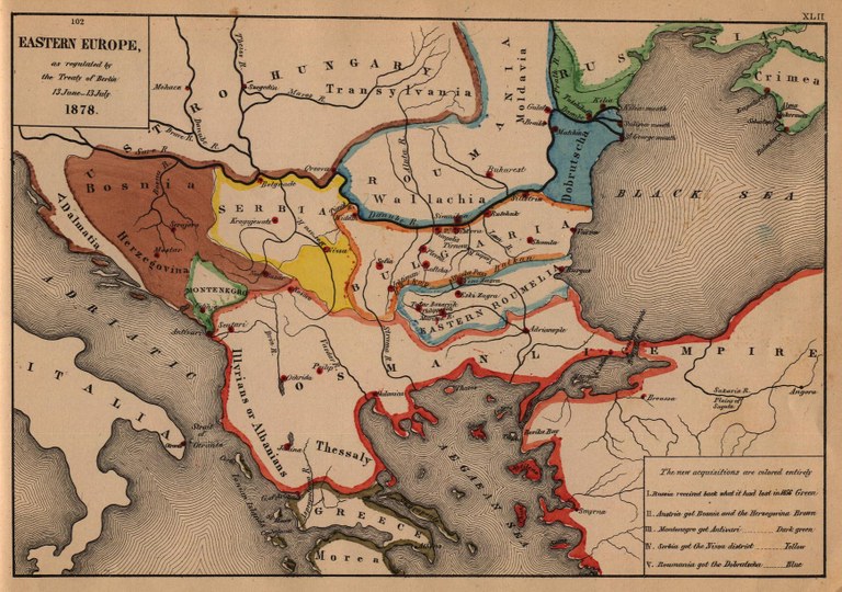
Die Länder Südosteuropas nach dem Berliner Kongress (1878)
erstellt von
—
zuletzt geändert
2020-05-25T11:15:45+02:00
University of Texas at Austin
University of Texas at Austin
Eastern Europe as regulated by the Treaty of Berlin 13 June–13 July 1878, Karte, 1884, unbekannter Ersteller; Bildquelle: Labberton, Robert H: An Historical Atlas, 1884. Digitalisat: University of Texas at Austin, http://www.lib.utexas.edu/maps/historical/eastern_europe1878.jpg. Courtesy of the University of Texas Libraries, The University of Texas at Austin.
Der Islam: Staat und Religion im Europa der Neuzeit@Islam in Europa@(BE)@freigabe
Die osmanische Geschichte Südosteuropas@Osmanische Geschichte Südosteuropas@(BE)@freigabe
Ost- und südosteuropäische Juden im 19. und 20. Jahrhundert@Ost- und südosteuropäische Juden@(BE)@freigabe
Panslawismus@Panslawismus@(BE)@freigabe
Vertreibung und Abwanderung der Muslime vom Balkan@Vertreibung der Muslime vom Balkan@(BE)@freigabe

