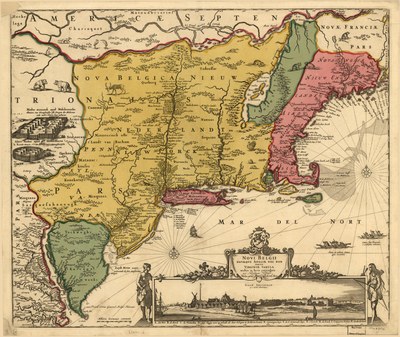
Karte von Nieuw Nederland, ca. 1684 IMG
by
—
last modified
2020-05-25T10:16:11+01:00
Library of Congress, gemeinfrei
Library of Congress, gemeinfrei
Nicolaes Visscher (I) (1618–1679), Novi Belgii Novæque Angliæ nec non partis Virginiæ tabula, Karte, handkoloriert, 46 x 55 cm; Quelle: Library of Congress Geography and Map Division; Digital ID g3715 ct000001, http://hdl.loc.gov/loc.gmd/g3715.ct000001, gemeinfrei.

British and American Constitutional and Democratic Models (18th–20th Century)@British and American Constitutional Models@(BE)@freigabe
Englische und amerikanische Verfassungs- und Demokratiemodelle (18.–20. Jahrhundert)@Englische und amerikanische Verfassungs- und Demokratiemodelle@(BE)@freigabe
Karte von Nieuw Nederland, ca. 1684
Map of Nieuw Nederland, ca. 1684
